The Dee Valley
The Dee Valley
-
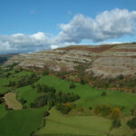
 Tarren Eglwyseg o Foel Morfydd - Eglwyseg Escarpment from Moel Morfydd
 -
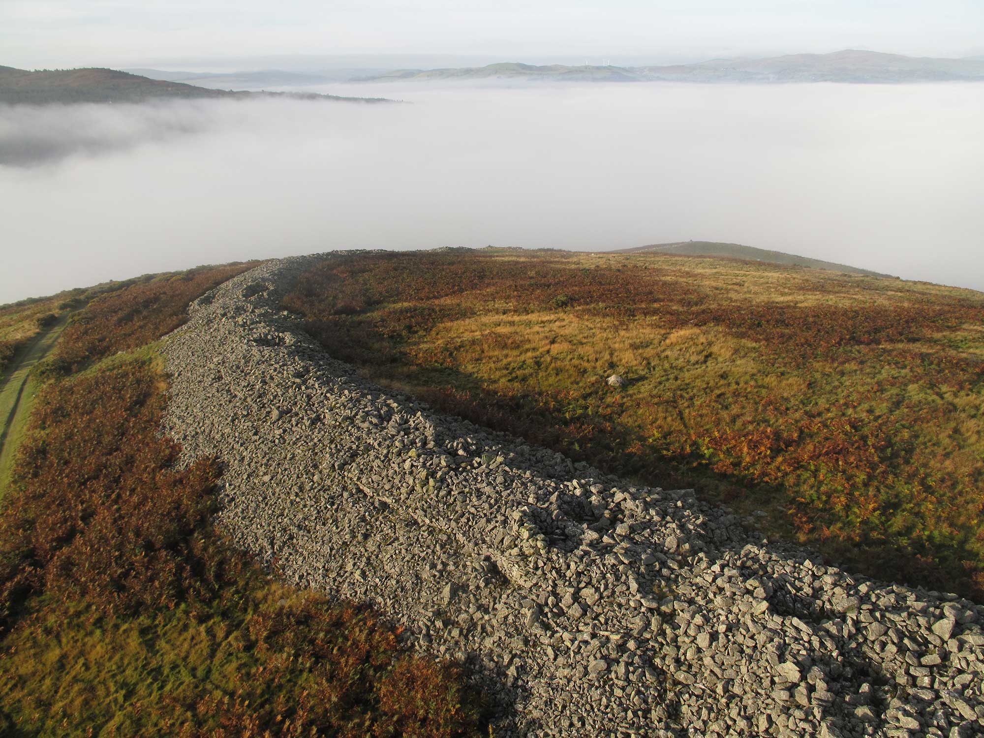 Bryngaer Caer Drewyn gyda gwrthdroad tymheredd yn y cefndir - Caer Drewyn Hillfort with temperature inversion in the background
 -
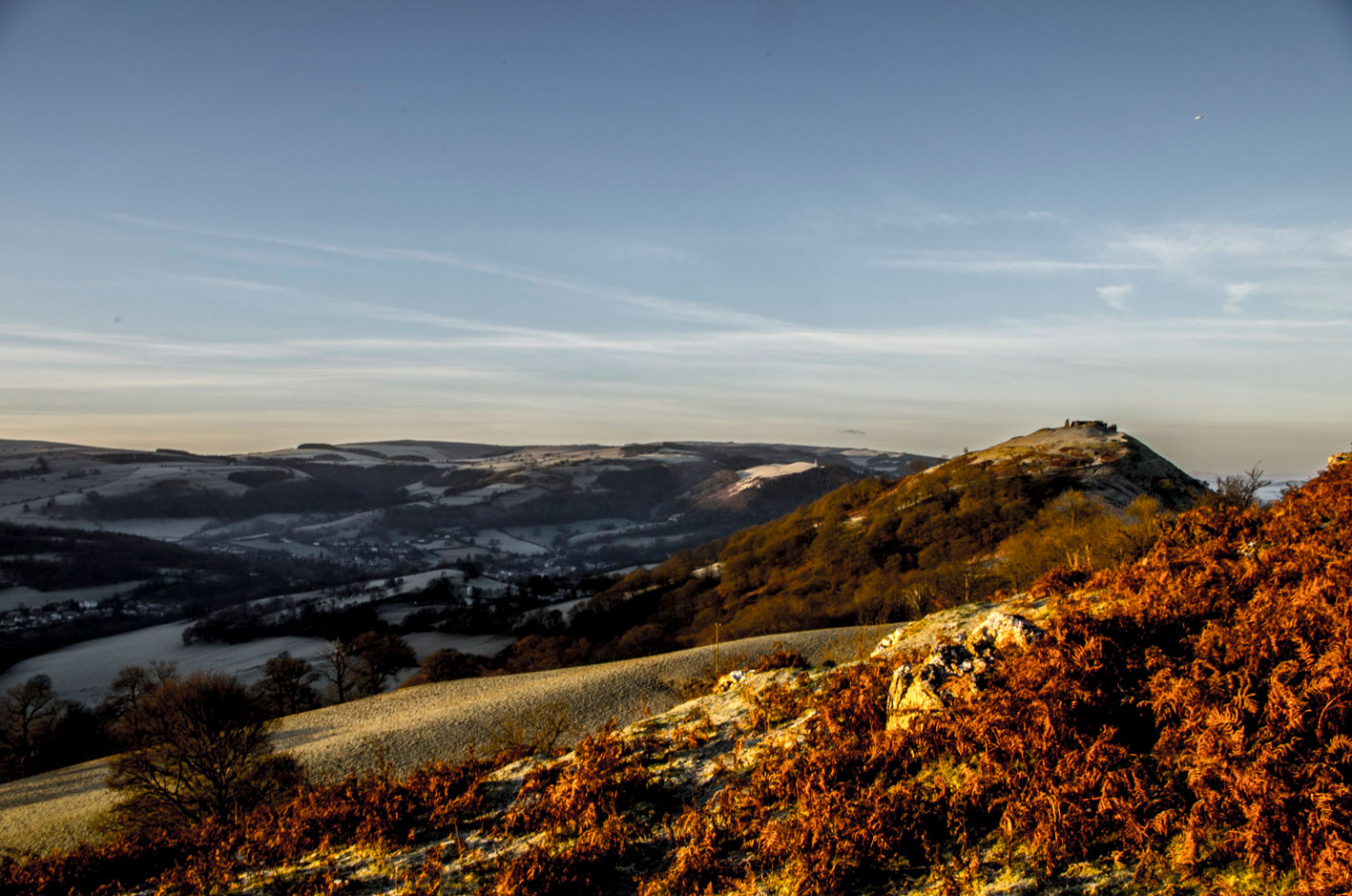 Castell Dinas Brân ar fore o aeaf - Castell Dinas Bran on a winter morning
 -
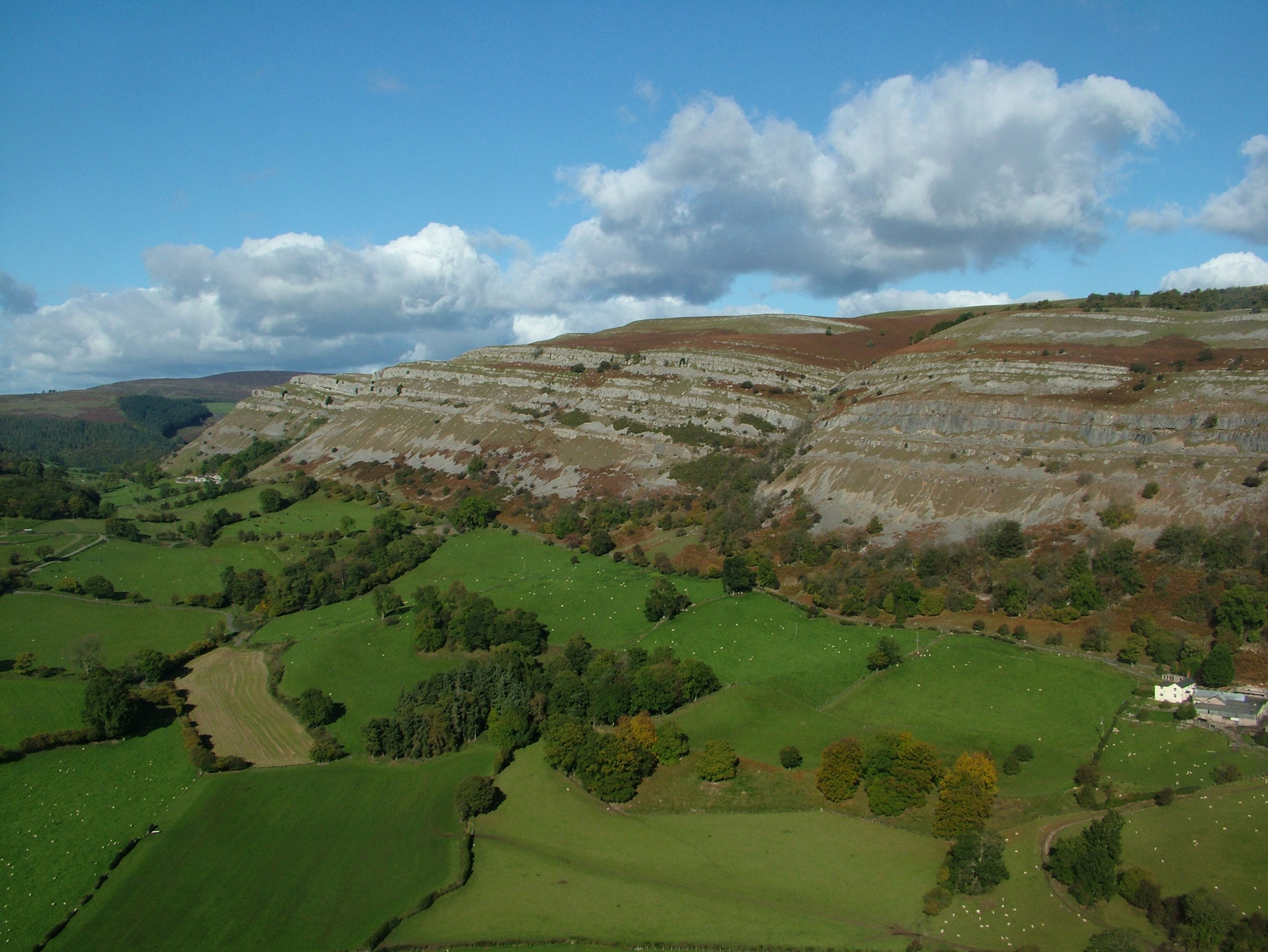 Tarren Eglwyseg o Foel Morfydd - Eglwyseg Escarpment from Moel Morfydd
 -
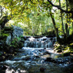
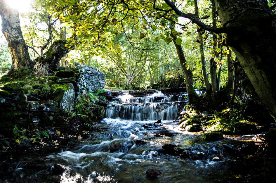 Rhaeadr Pen y Pigyn - Pen y Pigyn Waterfall
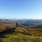
The unique character of the landscape within the Clwydian Range and Dee Valley AONB is distinct, recognisable and with elements that are both natural and human. Landscapes differ because geology, biodiversity, visual appearance, archaeology, history and culture vary from place to place. The interaction between people and their environment makes the AONB a living, working landscape as well as a place of recreation.
Some of Wales’ most iconic landscapes and heritage sites can be found in the southerly extension to the AONB, announced in 2011.
Did You Know?
The Pontcysyllte Aqueduct and Canal World Heritage Site is one of only three World Heritage Sites in Wales.
Natural Resources Wales’s LANDMAP system has broken the 230 square kilometres of the extended AONB into these areas:
Graianrhyd to Llandegla limestones
An area of distinctive carboniferous limestone scenery, including limestone hills, rock outcrops, valleys and woods. The trees and field boundaries follow the complex lines of rock exposure to form a small-scale, intimate enclosed farmland landscape. Limestone walls and buildings are characteristic. The Graig Site of Special Scientific Interest (SSSI) is protected for its limestone and acid grassland. The limestone includes outstanding cave sites with Neolithic remains.
Morwynion Valley
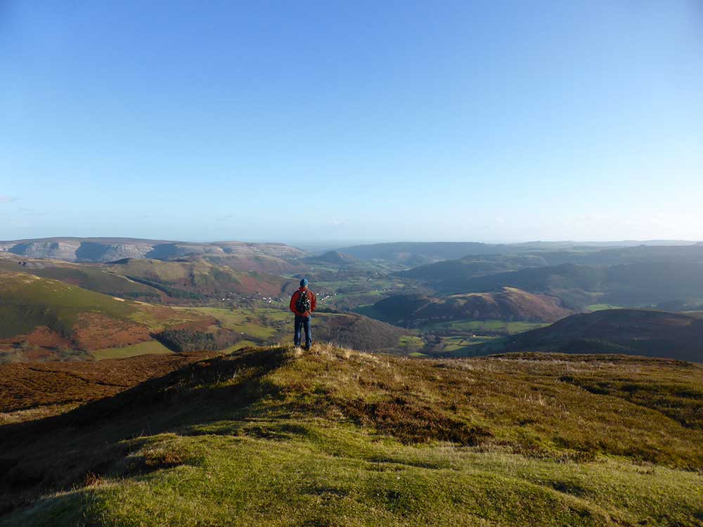
The valley is enclosed to the south by the high ridge of Llantysilio Mountain and Cyrn-y-Brain and to the north by the lower, undulating Llanelidan and Gwyddelwern Hills. The river rises in the narrow valley north of Llandegla Forest, flowing southwest to join the Dee at Carrog. The long, wide valley has gentle slopes of improved pasture bounded by a mix of hedgerows and stone walls. Caer Drewyn, a nationally important prehistoric fort, marks the area’s western end.
Llantysilio Mountain
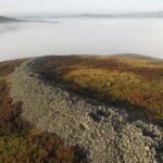
Part of one of the best preserved open moorland landscapes in North Wales with rare and important habitats and historic interests. The land, most of it unenclosed common, rises to over 500m. The dry heaths which cover most of the area are part of the internationally important Berwyn and South Clwyd Mountains European Special Area of Conservation (SAC) and provide habitat for upland breeding birds including black grouse, skylark, tree pipit and curlew. The ridge line shows widespread evidence of prehistoric settlement including monuments such as Moel y Gaer hillfort. The inclusion of land around Horseshoe Pass in the Register of Landscapes of Special Historic Interest highlights the importance of the area’s slate quarries.
Cyrn-y-Brain and Ruabon Mountains
This extensive area covers all of the unenclosed uplands and moors north of the Dee Valley. It includes Cyrn-y-Brain Mountain, Llandegla Forest and Ruabon Mountain as well as the more peripheral eastern areas of Llandegla Moors, Esclusham Mountain and Minera Mountain. Most of it is wide, open, remote, exposed moorland plateau and belongs to the Berwyn and South Clwyd Mountains SAC. Significant populations of breeding birds include merlin, ring ouzel, short-eared owl and golden plover. Chwarel Pant Glas is a key site for structural geology; there are limestone pavements at Aber Sychnant and a nationally important cave system at Minera. There is widespread evidence of prehistoric settlement in the form of cairns and standing stones on high ground.
Eastern slopes of Ruabon Mountain
An enclosed, mainly pastoral landscape which lies on the eastern edge of the area and faces Wrexham and the Cheshire Plain. Although mostly improved farmland, it contains many hedgerow trees and small wooded copses. There are long inward and outward views from among the isolated farms and small hamlets. Further east the isolated farms and small hamlets give way to larger settlements such as Penycae and Garth and the influence of coal mining becomes evident. Many of the small valleys contain remnants of ancient semi-natural woodlands (including upland oak and ash woodland) that are local wildlife sites. Pen y Gaer hillfort is of outstanding historic importance.
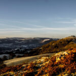
Vale of Llangollen and Dee Valley
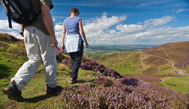
Enclosed to the north by Llantysilio and Ruabon Mountains and to the south by the northern part of the Berwyn Mountains, this is an iconic landscape of truly outstanding scenic and visual quality. It has inspired folklore, literature, painting and music over many centuries. The upland blocks and valleys were formed by faulting and mass movement and were later sculpted by glaciers. The area forms a dramatic gateway to North Wales with steep valley sides, deeply incised meanders and fossil terraces. On the north side the deep side valley of the Eglwyseg River is overhung by the carboniferous limestone crags of Eglwyseg Rocks (445m) – the most impressive scree slopes in Britain. Offa’s Dyke National Trail and the Panorama Drive, which run along the foot of Eglwyseg Rocks, offers stunning high level views across the vale. The south side of the Dee is characterised by a series of steep hanging valleys. The River Dee SSSI is important for its salmon, otter and wetland habitats. Ancient monuments include Castell Dinas Brân and Valle Crucis Abbey and much of the Pontcysyllte Aqueduct and Canal World Heritage Site lie within this area.
Berwyn Mountains North
On the southern edge of the Vale of Llangollen and Dee Valley, this landscape is distinctly different from the uplands further north. It is generally simpler, more remote and less settled. This area is part of the Berwyn Mountains SSSI, SAC and European Special Protection Area, which includes upland heath, blanket bog and mire of national and international importance. It supports hare, reed bunting, merlin, peregrine, red kite, hen harrier, golden plover and red and black grouse. Ceiriog Forest also provides habitat for red squirrels. The area’s peatlands are of national importance, showing scattered prehistoric evidence of land use and burial sites.
Chirk Estate to Froncysyllte
Lying at the south-eastern corner of the AONB, this landscape has a vital strategic location on the English-Welsh border and is a gateway to the Vale of Llangollen. It is part of the setting for the Pontcysyllte Aqueduct and Canal World Heritage Site and contains nationally important Chirk Castle. The wood pasture, parkland and veteran trees at Chirk are a national biodiversity priority habitat, supporting a range of saprophytes and invertebrates. There are a number of ancient woodlands and local wildlife sites both within the park and further north near Froncysyllte.
Looking back
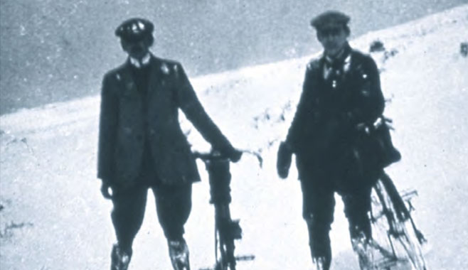
Anfielders “Wayfarer” and WP Cook climbing Nant Rhydwilym
The conquest in wintry conditions of one of the most challenging and beautiful passes in Wales, in the Berwyn Mountains. From an article dated 8th May, 1919.
