Hillfort: Moel Fenlli
Hillfort: Moel Fenlli
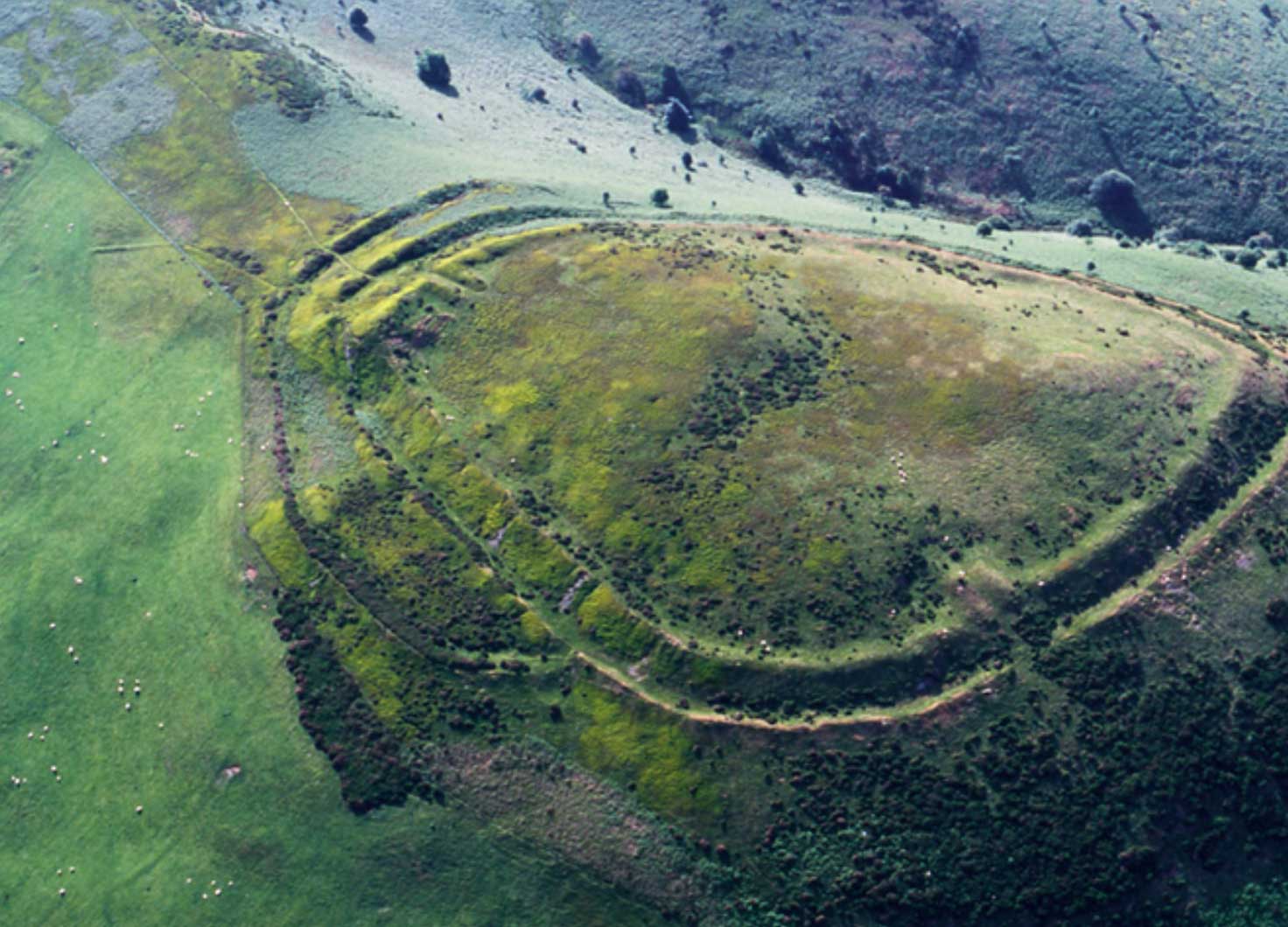
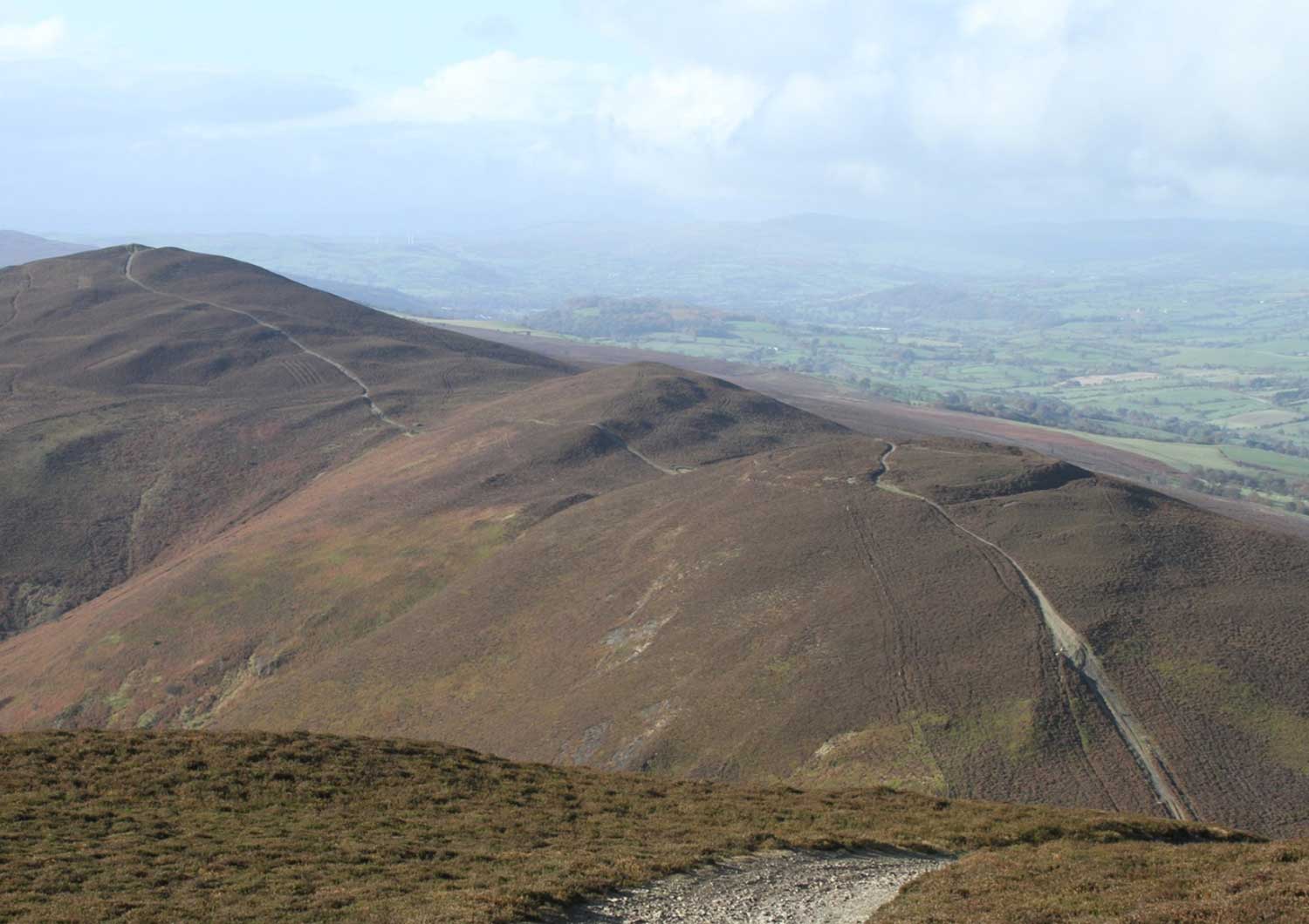
Moel Fenlli lies just south of Moel Famau, highest point of the Clwydian Range, above Bwlch Pen Barras on a prominent hill.
It is a multivallate hillfort with extensive ramparts on the north and east but with slight defences to the south where the natural slope is extremely steep.
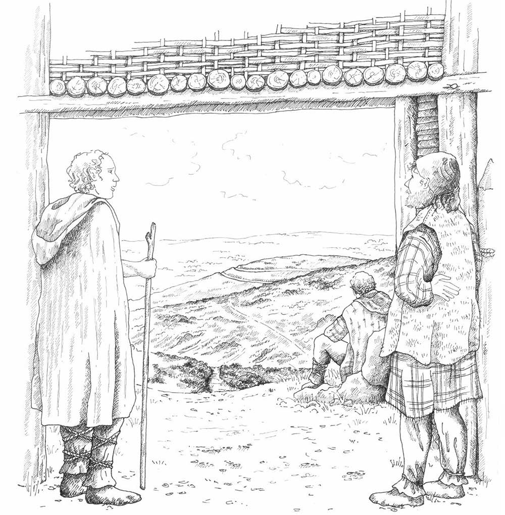
The ramparts enclose an area of 9.5 hectares with one original inturned entranceway at the west. It is not a true contour fort but dips from the east and there is a possible Bronze Age burial mound inside the fort at the highest point of the hill.
Did You Know?
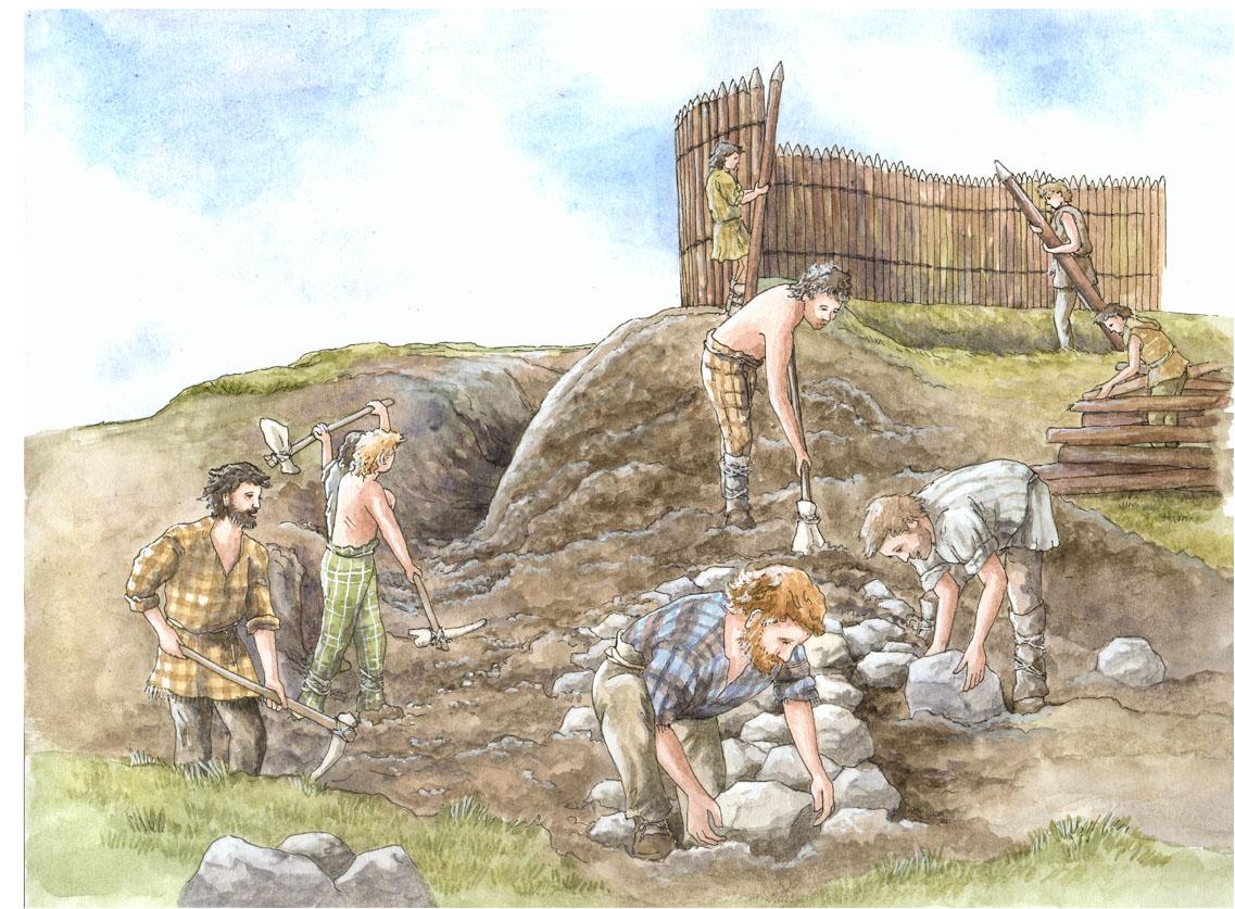
Evidence suggests that the people who lived inside the hillfort collected water from a spring in the centre. With evidence of a dam and 61 roundhouses, was this a thriving community or was it inhabited over a long period of time and change?
Moel Fenlli is first noted by the Tudor antiquarian William Camden in 1607 in Britannia: “For such is the wonderfull workmanship of nature that the tops of these mountaines resemble in fashion the battlements of walles. Among which the highest is Moilenlly, on the top whereof I saw a warlicke fense with trench and rampier, also a little fountaine of cleere water.”
Following the discovery of a hoard of 1,500 Roman coins on Moel Fenlli in 1816, which came to light after an accidental heather burn, W Wynne Ffoulkes began his programme of investigations here and on Moel y Gaer Llanbedr and Moel Arthur.
He describes “making incisions” in various parts of the fort – in the rampart to the north, the southern section of the rampart where a track enters the fort and in several possible hut platforms. He dug “trench after trench”’ without success. “Perseverance, however, at length brought to light a piece of white pottery, the rim of some vessel…” Work continued and soon they dug up a “remarkable knife and very good glazed Roman pottery, partaking the nature of samian ware”. These artefacts were in the collection of Ruthin Castle until the mid 1920s when Sir Mortimer Wheeler saw them but they have since been lost.
Both Ellis Davies in the 1920s and Forde Johnston in the 1960s, describe the site in detail and about two dozen hut platforms are noted as well as a dried-up spring and possible water dam. Forde Johnston suggests two main structural phases – the first being a complete circuit of bank, ditch and counterscarp bank.
Some exploratory excavation work took place by Bevan Evans prior to a visit by the Cambrians in the 1950s but the results of this work have not yet been found.
In 2006 Engineering Archaeology Services (EAS) carried out a topographical survey which identified 61 possible hut platforms.
How to get there
Take the A494 Ruthin to Mold road and follow the brown signs for Moel Famau Country Park. Moel Fenlli car park is opposite Moel Famau car park. While Offa’s Dyke National Trail runs along the base of Moel Fenlli, you can take a footpath directly up to the fort from the car park.
OS map: Explorer 265 OS. Grid reference: SJ163601
