Hillfort: Penycloddiau
Hillfort: Penycloddiau

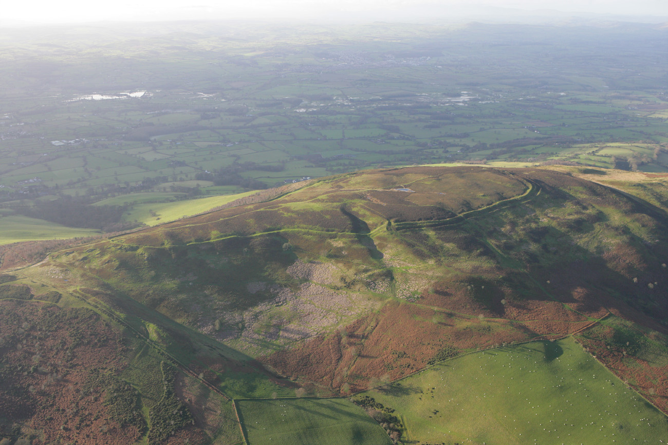

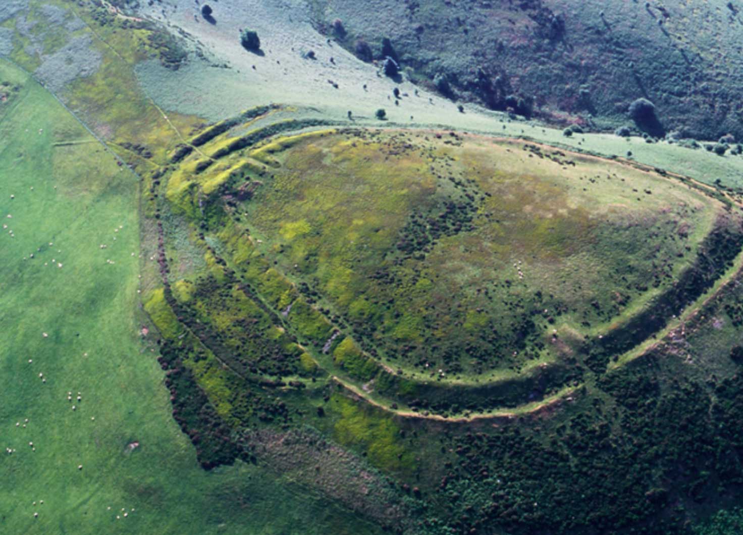
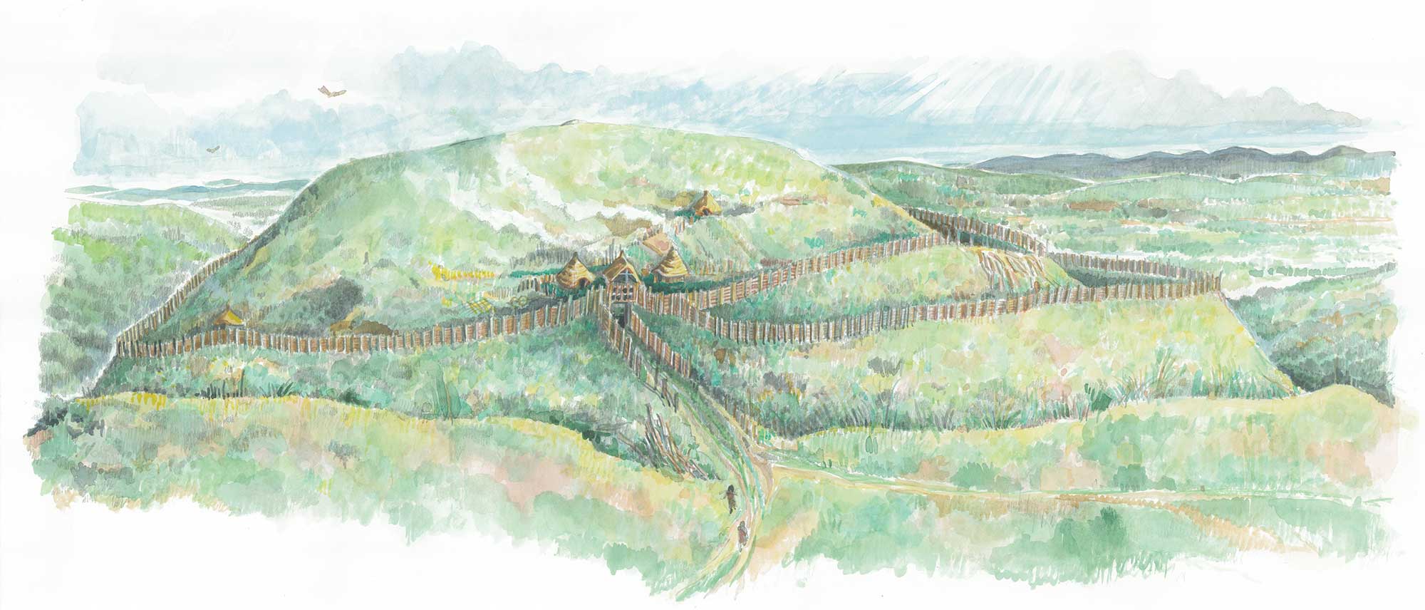
Penycloddiau is the largest hillfort on the Clwydian Range and one of the largest in Wales, enclosing an area of 21 hectares.
It has multiple concentric ditches (multivallate) and extensive ramparts (banks) to the north and north west, with entrances in the southern and eastern ramparts, and possibly also the western rampart. The ramparts may have been topped with a large wooden fence, giving shelter to the houses within the fort.
Evidence has also been found of roundhouses throughout the hillfort, a possible enclosure, and central ponds which might have provided the inhabitants with water.
Did You Know?
Funding for some of the scientific radiocarbon dating was raised by the community in nearby Llandyrnog by holding a coffee morning.
In the 1960s Forde Johnston suggested three possible stages of construction for the hillfort – confirmed in the early 21st Century by the Heather and Hillforts project – however people may have been using this site even before the Iron Age as there is a possible Bronze Age burial mound at the northern end of the hill.
As far as we can tell, there had been no excavations of the site prior to 2004. Much of the archaeological work undertaken between 2004 and 2010 took place as part of the Lottery funded Heather and Hillforts project. It included a topographical survey of the site which identified 43 possible platforms and an archaeological trench on the possible Bronze Age mound, carried out by the Clwyd-Powys Archaeological Trust (CPAT), and a geophysical survey which revealed new roundhouses and a possible enclosure, carried out by Engineering Archaeology Services (EAS) and their volunteers.
Between 2012 and 2018 excavations of Penycloddiau were used as a training opportunity for students of Liverpool University Archaeology Field School. This work, led by Dr Rachel Pope and Richard Mason was instigated by the successful connections made through the Heather and Hillforts project. Over 50 international students spent their summers learning the practical aspects of archaeology and excavation by coming to the Clwydian Range and Dee Valley AONB, and working on Penycloddiau.
As part of the project, a section of rampart on the eastern side of the fort, and a nearby roundhouse platform were excavated. Historically, it’s clear that at one time the rampart was a massive 3m wide dry stone wall with a track running round the exterior between it and a 2.5m ditch!
Unfortunately very little survived in the way of artefacts that would have helped excavators to date the rampart and the house, however many samples were taken with a view to carrying out radiocarbon C14 dating. It will be fascinating to know the results, which we will publish in due course.
Why Penycloddiau was built is another big question, beginning to be addressed by the excavations. It is vast – and the 3 metre wide dry stone wall, if it is similar for the whole circuit of the hillfort, represents a massive undertaking over a long period of time. There are suggestions that by building something like Penycloddiau, perhaps over several generations, it would help bring communities together.
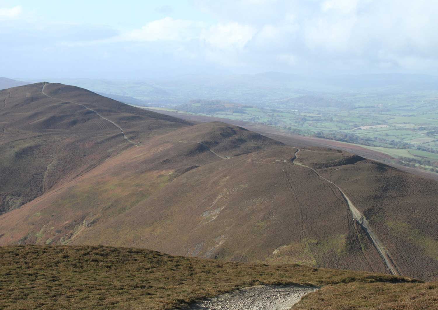
How to get there
From Bodfari near Denbigh or Llanbedr DC near Ruthin, take the B5429 to Llandyrnog. Follow the signs for Llangwyfan, continue on this small country road through the village and onwards to a small car park 1/4 mile from the site. The fort can be accessed directly as Offa’s Dyke National Trail passes through it.
OS map: Explorer 265 OS. Grid reference: SJ128678.
