Hillfort: Caer Drewyn
Hillfort: Caer Drewyn
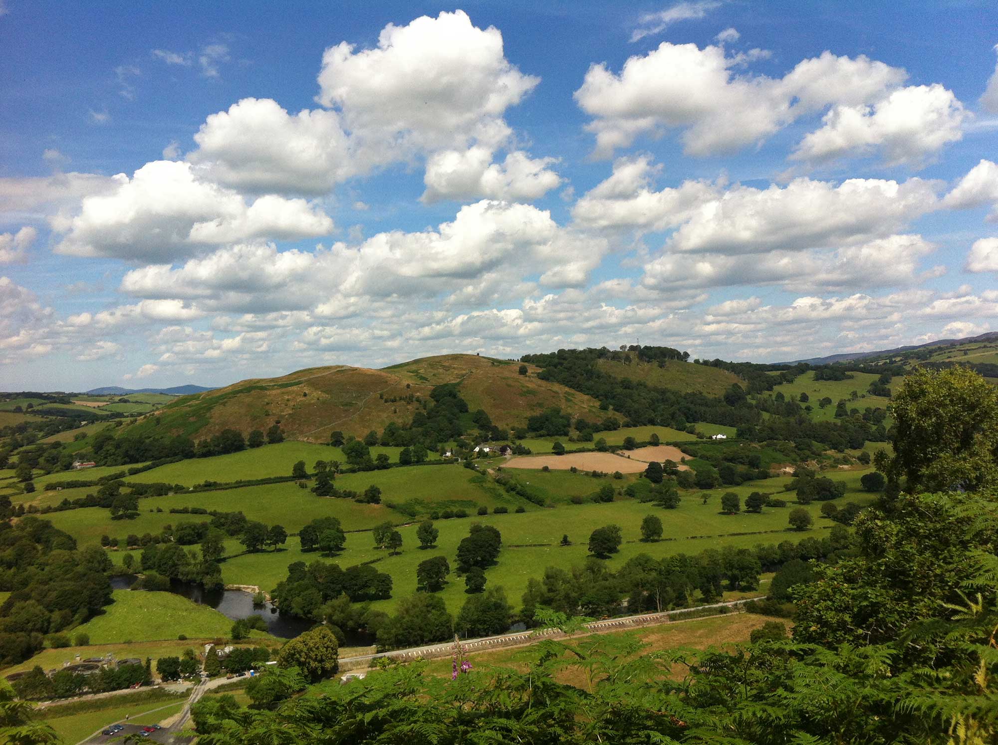
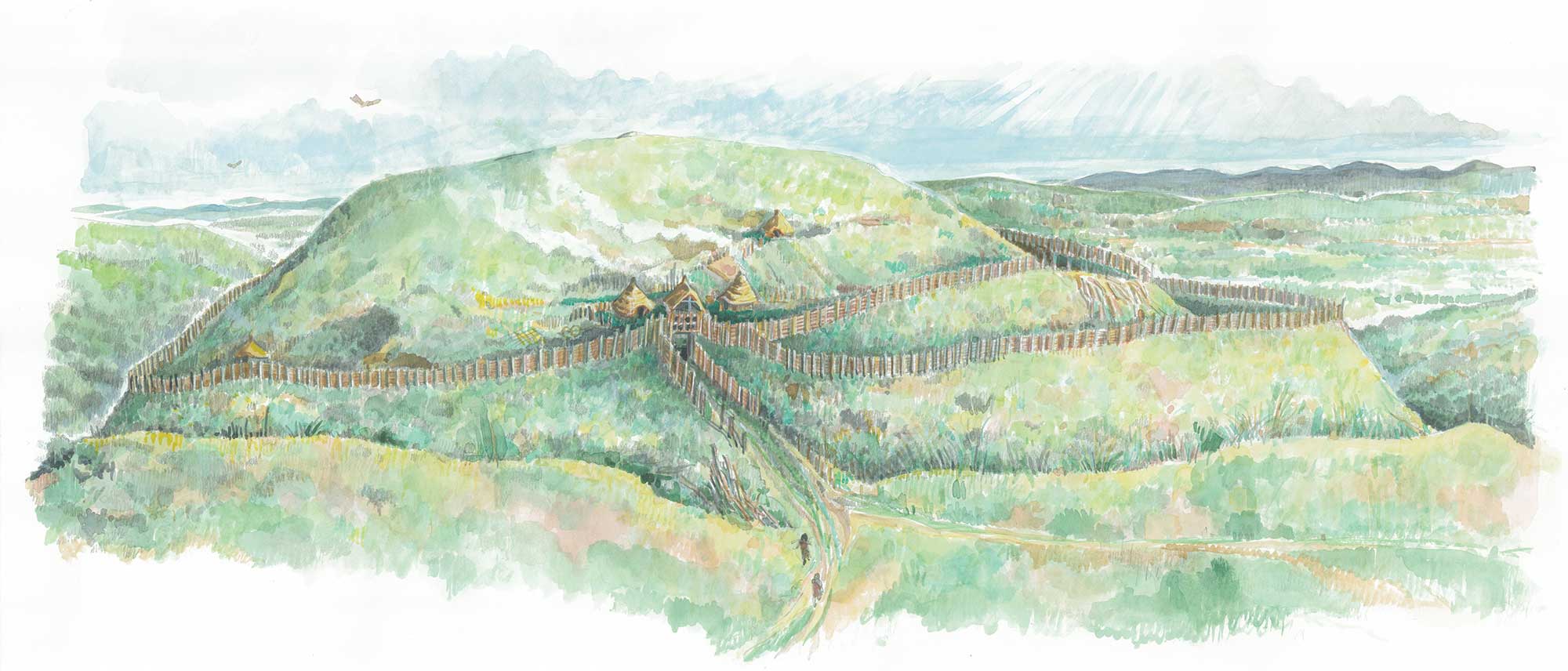
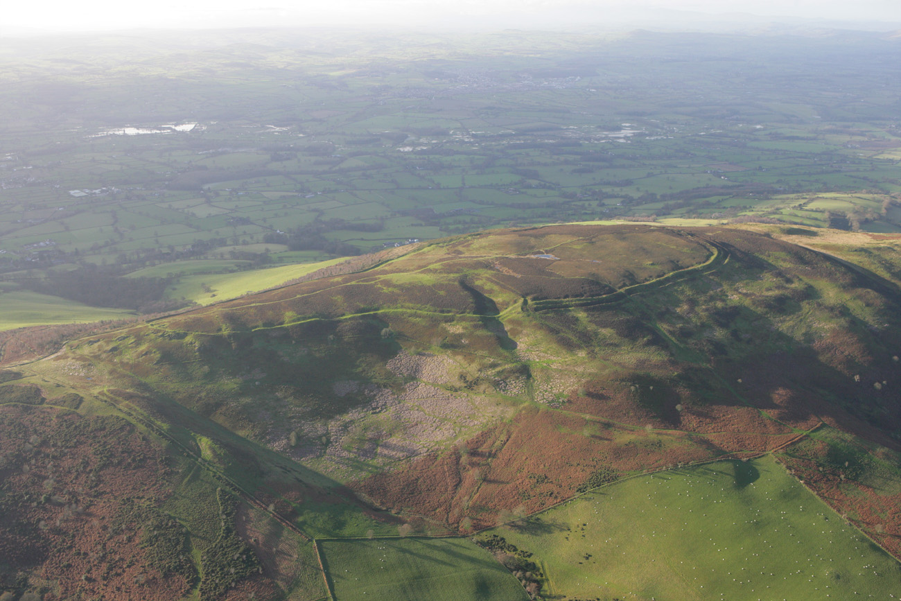
Caer Drewyn, one of the best-preserved Iron Age hillforts in Wales, overlooks the beautiful Vale of Edeyrnion.
This makes it the most southerly in our chain of hillforts, perched on the western spur of the ridge which runs between Llangollen and Corwen – not on the highest part but on a slope above the meeting place of the rivers Dee and Alwen.
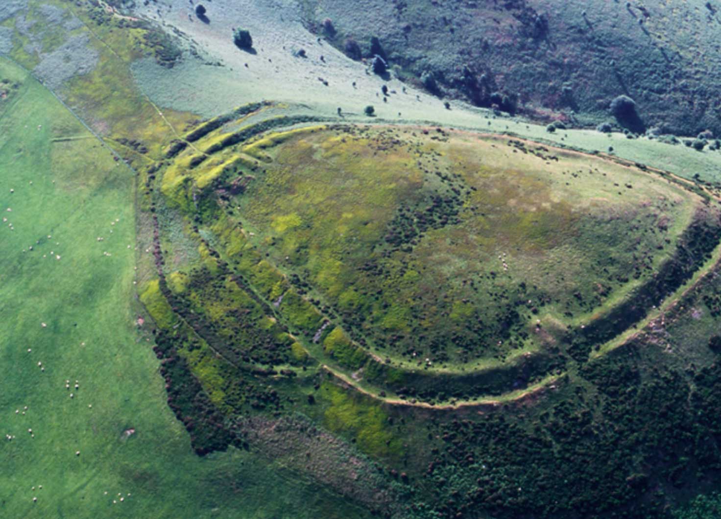
The first small fort here was a small enclosure built against the natural scarp. Today this is only partly visible as a grass-covered bank. The later, larger hillfort can be traced by a dry stone wall – Caer Drewyn doesn’t have earthen banks and ditches like other local hillforts.
These stone ramparts enclose an area of three hectares. There are two inturned entrances. One of them, at the highest point of the site in the north-east corner, appears to have a possible guardchamber. The other to the west contains foundations of rectangular buildings.
There is an external enclosure, or annex, which contains stone foundations of a possible hut platform.
Did You Know?
Caer Drewyn continued to be used long after the Iron Age had ended. Legend has it that it was used by Owain Gwynedd, self-proclaimed King of Wales, while Henry II was encamped on the Berwyns. It’s also believed to be the site where Owain Glyndwr gathered his troops after he proclaimed himself King of Wales in 1400.
Caer Drewyn is first mentioned by Edward Lhwyd in the late 17th century [i] as “a place where they kept their cattle in war time” and is also described by Thomas Pennant [ii] while on his tour of Wales.
The site was first truly examined by Reverend Hugh Pritchard in 1887 [iii]. He cleared the dry stone rampart to reveal a well-constructed wall of between 5 and 7 metres thick.
Willoughby Gardner investigated the dry stone wall in the 1920 s [iv] and published sections and photographs of its construction but did not excavate. Like Pennant he mentions the circular depressions in the wall and suggests they may be grouse butts.
In the History of Merionethshire from 1967, Bowen and Gresham suggest a four-phase development of the site [v].
As far as we know there has been no past excavation of Caer Drewyn. In 1993 and 1994 a study of lichen on the hillfort walls identified 60 different species, some of which are locally rare.
In 2006 Engineering Archaeological Services (EAS) carried out a topographical survey which identified eight possible hut platforms inside the main enclosure along with a possible phasing for the construction of the hillfort.
[i] Edward Lhwyd Parochialia
[ii] T.Pennant Tours in Wales
[iii] Rev. Pritchard 1887 Archaeologica Cambrensis
[iv] W Gardner 1922 Archaeologica Cambrensis 108-125
[v] Bowen and Gresham 1967 History of Merioneth
How to get there
The closest parking is at the local swimming pool on the B5437 opposite the bridge over the River Dee on the road from Corwen (A5). The site can be reached by public footpath clearly signposted on the north side of the B5437 just east of the swimming pool. The footpath follows a good track which winds below the western side of the hillfort. It then swings hard right, up the western flank, along the outside of the southern rampart and to the north-east gate.
OS map: Explorer 256 or 255 OS. Grid reference: SJ087444
